福岡の初心者向け登山・ハイキング10選|難易度・所要時間・アクセス比較
記事内にプロモーションを含む場合があります
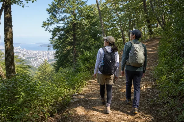
福岡で登山を始めるときは、山の標高よりも「どの登山口から、どのルートを、何時間歩くか」を先に見ましょう。標高622mの皿倉山でもケーブルカーを使えば徒歩約1.5kmの散策にできます。一方、標高365mの可也山は、山頂まで上りが続く低山です。
初めてなら、この順で選ぶと安心です
山頂を目指す最初の1座は天拝山か三日月山、まず山の空気を味わうなら風頭か皿倉山の山上散策が候補です。2時間前後歩けるようになったら立花山、四王寺山、平尾台へ。可也山は短時間でも階段と上りが続くため、歩き慣れてから選ぶと余裕を持てます。
所要時間は、公式ページや公式マップに掲載されたモデル時間を優先しています。
休憩、登山口までの移動、混雑は含まないため、初回は表示より30分以上の余裕を取り、日没より十分早く戻れる計画にしてください。
福岡の初心者向け登山・ハイキング10選を比較
ここでの「散策」「最初の1座」「次の段階」は、山の公式な難易度ではなく、歩行時間、坂の続き方、道の性質、途中で戻りやすいかを合わせた目安です。初心者向けとされる場所でも、雨の後や暑い日は難しさが変わります。
| 場所 | おすすめの歩き方 | 歩行の目安 | この記事での目安 | 先に知りたい点 |
|---|---|---|---|---|
| 城山(花立山) 筑前町・小郡市 |
麓の公園・散策路から体力に合わせる | コース選択で調整 | 散策 | 平坦部が多いが山頂付近は急になる |
| 風頭 北九州市門司区 |
9合目から風頭へ往復 | 約20分 | 散策 | 9合目までは車移動。門司港駅から歩く場合は別計画 |
| 皿倉山 北九州市八幡東区 |
ケーブルカー往復+山上散策 | 徒歩1.5km・約60分 | 散策 | 運休日と最終便を事前確認 |
| 天拝山 筑紫野市 |
天拝公園から九州自然歩道を往復 | 山頂まで約30分・往復約1時間 | 最初の1座 | 天神さまの径は少し険しいため初回は避ける |
| 三日月山 福岡市東区 |
三日月山霊園側から往復 | 約1時間30分 | 最初の1座 | 駐車場・トイレあり。雨後は木の根や土で滑りやすい |
| 立花山 福岡市東区・新宮町 |
下原側から山頂へ往復 | 山頂まで約60分(片道) | 最初の1座 | 三日月山まで縦走すると時間と体力が増える |
| ABURAYAMA FUKUOKA 福岡市南区 |
市民の森側を起点に園内を歩く | 1〜2時間に調整 | 次の段階 | 牧場側と市民の森側は車で通り抜けできない |
| 四王寺山 宇美町ほか |
県民の森センター発着Bコース | 約3km・約1時間30分 | 次の段階 | 公共交通は予約・徒歩時間を含めて計画 |
| 平尾台 北九州市小倉南区 |
公式の初心者向け約3kmコース | 約1時間30分 | 次の段階 | 木陰が少なく、霧では方向を見失いやすい |
| 可也山 糸島市 |
師吉側から山頂・展望所へ往復 | 山頂まで約1時間(片道) | 次の段階 | 長い階段と上りが続く。路線バスは本数が少ない |
散歩の延長から始めやすい3か所
登山靴や長時間の山歩きにまだ慣れていない人は、短いコースや乗り物で高度を上げられる場所から始めると、山道での歩き方や持ち物を試せます。ただし、舗装路だけではないため、滑りにくい靴は必要です。
城山(花立山)|歩く距離を自分で調整しやすい
筑前町では城山・じょんやま、小郡市では花立山と呼ばれる標高130.9mの里山です。福岡県観光連盟の案内では、平坦な道が多く「散歩の延長」として歩け、複数の散策コースから体力に合わせて選べるとされています。
最初から山頂だけを目標にせず、麓の城山公園と散策路を組み合わせるのが向いています。山頂付近は勾配がきつくなるため、疲れが出る前に折り返しましょう。車では筑後小郡ICから約10分が目安です。
風頭|9合目から約20分で関門海峡の眺めへ
風師山の風頭(かざがしら)は、9合目まで車で上がると、ゆるやかな勾配を約20分歩いて展望地を目指せます。関門海峡、周防灘、玄界灘まで見渡せる日があり、「まず景色のある山道を歩いてみたい」という人に取り入れやすいコースです。
門司港駅から歩く登山コースもありますが、9合目発の約20分散策とは負荷が異なります。初回は9合目発着にして、公式トレッキングマップを保存してから出発すると迷いを減らせます。
皿倉山|ケーブルカー往復なら徒歩1.5km・約60分
皿倉山は、ケーブルカーとスロープカーを乗り継いで山頂付近へ行けます。北九州市の「絶景スポットでリフレッシュ」コースは、ケーブルカー往復を利用し、歩く部分が約1.5km、所要時間約60分です。
標高だけを見ると初心者には高く感じますが、歩く量を明確に抑えられるのが利点です。ケーブルカーには運休日があるため、運行日、最終便、天候による変更を当日に確認してください。7kmを超える別コースは、同じ皿倉山でも初回向けではありません。
初めて山頂を目指しやすい3座
短い山でも、上り下り、土、石、木の根があると平地の1時間より疲れます。最初の1座は、往復1〜2時間程度で登山口にトイレがあるルートを選び、同じ道を戻る計画にすると判断が簡単です。
天拝山|公園から山頂まで約30分
天拝山は標高257.4m。天拝公園から山頂まで約30分、往復約1時間が目安です。初回は整備された九州自然歩道を往復しましょう。もう一つの「天神さまの径」は市の資料でも少し険しいルートと案内されているため、同じ山でも選ぶ道を分けることが大切です。
登山口の天拝公園には洋式トイレと駐車場があります。公園駐車場は35台で、満車時は市営大門高架下駐車場も案内されています。公共交通では「二日市温泉」バス停から公園まで徒歩約7分です。
三日月山|霊園側は駐車場・トイレがある
三日月山は標高272m。三日月山霊園そばの登山口には、登山者が利用できる駐車場とトイレがあります。福岡市のおすすめルート図の区間時間を合計すると、霊園側から山頂まで上り約50分、下り約40分で、休憩を除き約1時間30分が目安です。
山頂は平らな部分が広く、アイランドシティ、海の中道、志賀島方面を見渡せます。体力が残っていても、初回は立花山へ縦走せず、同じ霊園ルートで下る方が時間を読みやすくなります。
立花山|クスノキの森と山頂の眺望
立花山は標高367.1m。福岡市が紹介する下原側のコースは、登山口から山の神池、クスノキ群生林を経て山頂まで約60分です。三日月山より歩く時間を少し延ばし、森らしい道を体験したい人に向きます。
立花山から三日月山までは公式コースでさらに約30分です。縦走すると下山ルートと移動が増えるため、初回は立花山だけの往復にし、早い時間に出発してください。福岡市も登山道に歩きづらい箇所があると注意を促しています。
1〜3時間歩くハイキングへ進む4か所
1時間の山歩きで余力を残せたら、距離のある周回路や、上りが続く山へ進みます。この段階では、コースを事前に保存し、折り返す時刻を決め、水と行動食を持つことが必要です。
ABURAYAMA FUKUOKA|歩く量を1〜2時間に調整
油山では、市民の森側を起点に自然観察センター周辺や園路を組み合わせると、1〜2時間のハイキングに調整できます。最初から油山山頂だけを目指すのではなく、園内マップを見て、戻る道が分かる範囲から歩くのが安全です。
車の入口は牧場側と市民の森側の2か所に分かれ、施設内を車で通り抜けできません。登山・自然観察センターを目的にする日は市民の森側入口を選びます。駐車場は9時〜18時、普通車は入庫から3時間まで300円、以降1時間ごとに100円です。バスは運行期間と曜日が限られるため、当日のアクセス情報を確認してください。
四王寺山|3km・約1時間30分の周回から
宇美町、大野城市、太宰府市にまたがる四王寺山には、古代山城の大野城跡があります。四王寺県民の森センター発着のBコースは、増長天礎石群、焼米ヶ原、原口城門跡などを巡る約3km・約1時間30分の周回です。
公共交通では、JR宇美駅から徒歩約80分、西鉄バス「県民の森入口」から徒歩約60分かかります。予約制のAIオンデマンドバス「のるーと宇美」も案内されています。登山そのものより登山口までの移動が長くなる場合があるため、車か予約交通を含めて計画しましょう。
平尾台|約3kmの初心者コースでも天候対策が必要
平尾台は石灰岩が点在するカルスト台地です。北九州市が2026年5月に公開した「はじめての平尾台」には、トレッキング初心者向けの約3km・約1時間30分のコースが掲載されています。山頂だけを目標にせず、公式マップの短い周回から歩くのが向いています。
草原は森より木陰が少なく、夏は日差しと暑さの影響を受けます。霧が出ると目印が見えにくく、石灰岩のくぼみや濡れた石にも注意が必要です。貫山まで足を延ばすコースは別の登山計画と考え、初回の短いコースと混同しないでください。
可也山|片道約1時間でも上りが続く
可也山は標高365mで、糸島富士とも呼ばれる独立峰です。師吉側の登山道では石切場、可也神社、第1展望所などを通り、糸島市観光協会の案内では「師吉公民館」バス停から山頂まで徒歩約1時間です。
距離だけを見ると短く感じますが、長い階段と上りが続きます。山頂標識の先にある展望所まで歩くこと、下山にも時間がかかることを見込み、往復2時間に休憩分を足してください。バスは本数が少ないため、行きと帰りをセットで確認します。
低山でも「短いから簡単」とは限らない
初心者向けの低山で差が出るのは、標高よりも道の状態です。次の条件が重なる日は、普段より短いコースを選んでください。
- 雨の当日・翌日:土、木の根、石段が滑りやすくなります。
- 夏の晴天:平尾台のように木陰が少ない場所は体温が上がりやすくなります。
- 霧・低い雲:分岐や遠くの目印が見えにくくなります。
- 強い風:山頂や開けた稜線では、麓より体が冷えます。
- 夕方:森の中は市街地より早く暗く感じます。日没時刻ではなく、余裕を持った下山完了時刻から逆算します。
初回は雨天なら延期で構いません。「せっかく来たから」と予定を延ばさず、登山口で天候や体調に不安があれば散策に切り替えるか、引き返しましょう。
初心者の服装と持ち物
1〜2時間の低山でも、両手が空く小さなリュックを使います。ペットボトルだけを手に持って歩くと、転びそうなときに手を使えません。
- 靴:底の溝が残ったトレッキングシューズ、または滑りにくい運動靴
- 服:乾きやすい長袖・長ズボン。綿だけの厚い服は汗冷えしやすいため避ける
- 水:季節、距離、体格に合わせて余裕を持つ。夏は出発前にも水分を取る
- 行動食:小袋の菓子、ようかん、エネルギー補給食品など、歩きながらではなく休憩時に食べやすい物
- 雨具:傘だけにせず、上下またはポンチョ型の雨具
- 地図:公式コース図を保存し、地図アプリはオフラインでも確認できる状態にする
- 補助品:帽子、タオル、ティッシュ、ごみ袋、絆創膏、モバイルバッテリー
出発前に確認する5項目
前日と当日の2回、次の項目を確認します。施設の開園と登山道の通行可否は別の場合があるため、園内マップや自治体のお知らせまで見てください。
- 天気と警報:登山口だけでなく、山がある市町村の予報を見る
- 通行情報:工事、倒木、野焼き、災害後の通行止めがないか確認する
- 交通:駐車場の利用時間、バスの帰り便、ケーブルカーの最終便を確認する
- 計画共有:山名、登山口、ルート、戻る予定時刻を家族や知人へ伝える
- 撤退時刻:予定の山頂時刻に遅れたら、山頂までの距離に関係なく戻る
福岡県警察の山岳情報ページでは、山岳遭難防止のポイントと登山計画書の電子申請・印刷用PDFが案内されています。短い低山でも、単独で歩くときや分岐が多いコースでは計画を残しましょう。
登山と一緒に楽しめる福岡のおでかけ情報
最初から登山と観光を詰め込みすぎず、下山後に時間と体力が残ったときだけ立ち寄れる候補を決めておくと動きやすくなります。
- 天拝山の前後は、筑紫野市総合公園ガイド、二日市温泉の日帰り温泉ガイド、筑紫野 天拝の郷ガイドも参考になります。
- 油山の施設、駐車場、季節の楽しみ方は、油山・ABURAYAMA FUKUOKAガイドで確認できます。
- 平尾台の子ども向け水遊びは、ソラランド平尾台「せせらぎ広場」ガイドにまとめています。
- 宿泊を伴う自然遊びへ広げるなら、福岡のキャンプ場ガイドから地域別に探せます。
情報確認日:2026年8月3日。所要時間、施設の開園、交通、登山道の状態は変更される場合があります。出発前に各公式ページと現地案内を確認してください。
福岡の今日のイベントを探す
2026/09/25 の福岡イベント
今日開催中のイベントです。明日以降、週末、ジャンル別の予定はイベントカレンダーで探せます。
- SLICE OF THE KNOT vol.2|9月25日福岡・大名で開催、薪窯ピッツァ×アート×DJ9/25 (福岡市、中央区)
- 神幸式大祭2026|太宰府天満宮で9月21日〜25日、神幸行列と千灯明9/21 ~ 9/25 (太宰府天満宮)
- 第102回飯塚花火大会2026|9月25日に遠賀川中之島で約7,000発9/25 (飯塚市)
- 夏目友人帳 エポスカード期間限定ショップが博多マルイで7月18日開幕7/18 ~ 9/26 (博多マルイ、福岡市、博多区)
- MEAT&CHEERS FUKUOKA 2026|9/17〜27福岡大名ガーデンシティで開催9/17 ~ 9/27 (福岡大名ガーデンシティ、福岡市、中央区)
- TVアニメ「光が死んだ夏」展が博多マルイで9月5日開幕9/5 ~ 9/27 (博多マルイ、福岡市、博多区)
- 博多阪急「Botanical & Wellness Marché」9/24~27開催|植物と癒やしの4日間9/24 ~ 9/27 (福岡市、博多区、博多阪急)
- 大人気!魔法の美術館がBOSS E・ZO FUKUOKAに再登場!7月14日開幕7/14 ~ 9/27 (BOSS E・ZO FUKUOKA、福岡市、中央区)
- 映画『超かぐや姫!』POP UP STOREがららぽーと福岡で9/18開幕|限定グッズ・スタンプラリー9/18 ~ 9/27 (ららぽーと福岡、福岡市、博多区)
- 福岡PARCO「HELLO! PUPPET SUNSUN」9/11開幕|90点超のグッズ&入場方法9/11 ~ 9/27 (福岡市、中央区、福岡PARCO)
- 福岡PARCO「ドラッグ王子とマトリ姫11th&スタンドマイヒーローズ10th」周年ストア|9/19開幕9/19 ~ 9/27 (福岡市、中央区、福岡PARCO)
- 大丸福岡天神店「第44回 全国うまいもの大会」9/23開幕|551HORAI・赤福水ようかん登場9/23 ~ 9/28 (福岡市、中央区、大丸)
- TRIPLE DECKER LONDONが大丸福岡天神店に九州初出店|9/23~29限定9/23 ~ 9/29 (福岡市、中央区、大丸)
- 「ペンキ画家SHOGEN展【ART PARTY】博多阪急で9/23開幕」9/23 ~ 9/29 (福岡市、中央区、博多阪急)
- ザ・シネマナイト フクオカ2026|7月11日〜海の中道で無料屋外映画7/11 ~ 9/30 (ザ・ルイガンズ、福岡市、東区)
- 博多駅「3時のドーナツ」再出店|9/16~30 マイングで豆腐ドーナツ初販売9/16 ~ 9/30 (マイング、福岡市、博多区)
- 福岡PARCO「ナルミヤキャラクターズ POP UP SHOP」9/18開幕|限定グッズ&コラボメニュー9/18 ~ 9/30 (福岡市、中央区、福岡PARCO)
- 「カイジ」連載30周年POP UP STOREが博多マルイで9/18開幕|指ギロチン&“沼”企画も9/18 ~ 10/4 (博多マルイ、福岡市、博多区)
- 博多阪急「ART PARTY 2026」9/23開幕|SHOGEN・ヘラルボニーなどアート企画集結9/23 ~ 10/6 (福岡市、博多区、博多阪急)
- FaN Week 2026|福岡の街がアート会場に!9/19〜10/12開催9/19 ~ 10/12 (福岡市)
- 新天町デジタル商品券2026攻略|市外も購入可!20%お得・買い方と11月30日の注意点6/15 ~ 11/30 (新天町、中央区)
投稿者のプロフィール

最新の投稿
-

-
2026.09.01.
福岡のホテル、旅館、宿泊施設を紹介 九州ふっこう応援割2026【福岡県】予約開始日・対象ホテル・50%割引の最新情報 -
-
2026.08.28.
福岡のおすすめサウナ 湯らっくすAMBIENT 福岡今泉店|料金・営業時間・予約方法 -
-
2026.08.27.
福岡のおすすめサウナ 福岡市内の温泉・銭湯おすすめ2026|日帰り入浴・スーパー銭湯・サウナ -
-
2026.08.10.
福岡紅葉情報 福岡の紅葉と温泉を楽しむ宿5選|秋月・英彦山・太宰府・原鶴温泉



関連記事
-
-
2026年7月15日
グルメ ABURAYAMA FUKUOKAで「KIDS NIGHT」8月8日開催|夏の夜を親子で楽しむ油山イベント -
-
2026年4月4日
グルメ 油山キッチンカーバトル2026|ABURAYAMA福岡で4月開催 -
-
2026年3月30日
グルメ ABURAYAMA FUKUOKA 3周年ありがとう祭開催|2026年4月4日~南区油山で特別イベント -
-
2026年3月17日
レジャー・観光 アブラヤマーケット開催!椿油しぼり体験も|ABURAYAMA FUKUOKA(3月21日・22日) -
-
2026年1月23日
レジャー・観光 【福岡・油山】Snow Peakで春限定「キッズデープラン」3月26日~30日開催! -
-
2025年11月7日
レジャー・観光 申込は11月19日まで!【福岡・ABURAYAMA FUKUOKA】しめ縄リースづくり体験|12月13日開催 -
-
2025年10月3日
レジャー・観光 アブラヤマーケット2025|福岡・ABURAYAMA FUKUOKAで10月11日・12日開催